
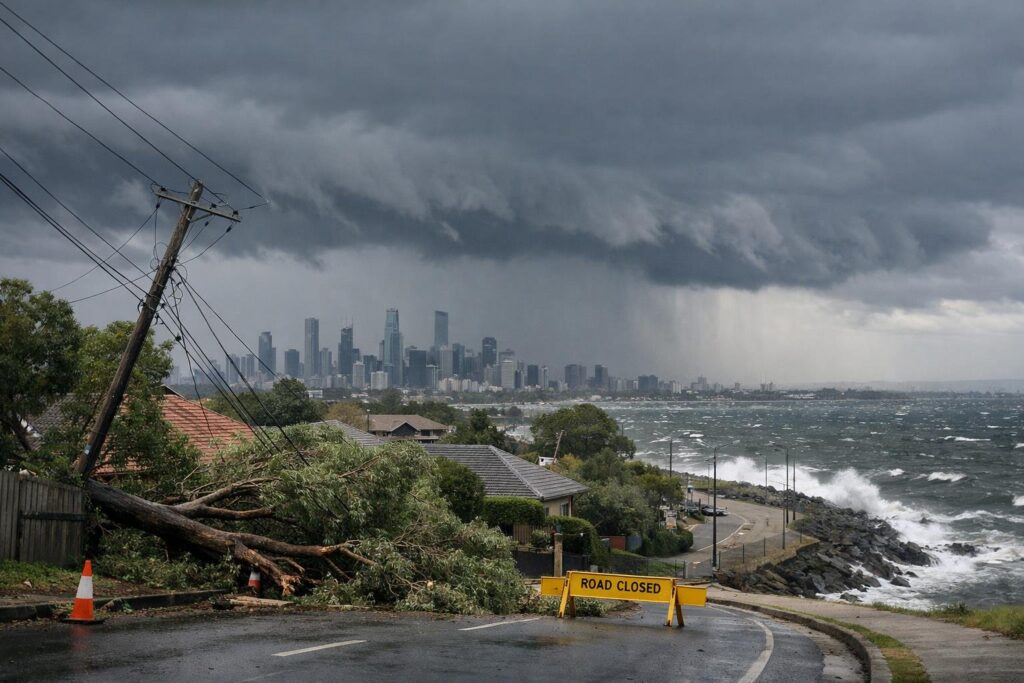
Skies over Melbourne are primed for a burst of energy, with forecasters warning of gusty conditions that could challenge even well‑prepared homes. The setup looks classic for the southeast: a tight pressure gradient, a fast‑moving front, and enough instability to turn breezes into damaging squalls. “Treat every wind warning as a tree‑fall warning,” goes a familiar safety refrain, and this weekend, that advice feels timely.
What the latest forecast suggests
Models point to a corridor of strong northerlies ahead of the front, sharpening into gale‑force gusts late Saturday and into Sunday. Peak bursts near exposed coasts and elevated terrain could top 90–100 km/h, with alpine and headland sites flirting with even higher numbers. Between showers, expect fast ramp‑ups in speed as clear slots mix stronger momentum to the surface.
Forecasters highlight two risk windows: the pre‑frontal surge on Saturday evening and the squally wrap‑around flow behind the change through early Sunday. In short, it may feel like a “now you see it, now you don’t” pattern—until a branch snaps or a poorly anchored item flies.
Areas most exposed to the blow
Topography and coastline shape how wind bites. The Dandenong and Yarra Ranges funnel and accelerate flow, putting ridgeline suburbs such as Olinda, Sassafras, and Mount Dandenong in the crosshairs for tree and powerline impacts. “Tall mountain ash are majestic, but in wind they can be unforgiving,” say longtime residents.
Bayside strips from Brighton to Sandringham, and out along the Mornington Peninsula to Sorrento and Portsea, can see clean, unbroken fetch off the water. The Surf Coast—Torquay, Anglesea, and exposed headlands—often wears the brunt when gradients tighten. Open western suburbs like Werribee and Melton lack shelter, while Docklands and Collins Street “canyons” can locally amplify gusts.
New estates with young street trees and light fencing are also at risk, as are properties with broad‑crowned eucalypts over driveways and roofs.
How to prepare without overthinking it
Wind safety is about removing projectiles and building redundancy. “Secure it now, not when the gusts arrive,” is a mantra worth repeating, because a rushed job is an unsafe job.
- Tie down or store loose items: outdoor furniture, bins, trampolines, ladders, and construction materials. Check that umbrellas are shut and latched.
- Park away from large trees and brittle branches; avoid spots under power lines and aged gums.
- Charge phones, power banks, and essential devices; keep torches and spare batteries handy.
- Clear gutters and downpipes so wind‑driven rain doesn’t back up into ceilings or walls.
- Anchor boats, kayaks, and trailer covers; verify moorings and remove light sails.
- Close windows and internal doors; a tighter envelope reduces turbulent inflow.
- Keep medications and critical documents accessible; check on elderly neighbours.
- If you rely on powered medical equipment, confirm backup plans with your provider.
Travel, power and events
Public transport is notoriously vulnerable to tree fall, with lines disrupted by debris and precautionary speed limits. Give yourself more time, carry water, and watch operator alerts. Airports may lean into delays or crosswind procedures, so pack patience alongside your charger.
Driving demands extra margin: two hands on the wheel, slower speeds, and wider gaps from high‑sided vehicles that catch the wind. Avoid parking beneath street trees, especially on saturated verges. Cyclists should plan sheltered routes or consider a safer day.
On water, strong wind warnings mean rough seas and treacherous bars; rock fishing and small‑craft outings should be postponed. Beachgoers can expect messy surf and unexpected sand‑blown hazards.
Power networks face branches slapping lines, insulators arcing in spray, and automatic trips to protect equipment. If lines are down, stay well clear and phone your distributor—assume everything is live and extremely dangerous.
Why trees fail on windy weekends
It’s not just the wind; it’s soil moisture, root health, and hidden decay. After wet spells, roots lose grip, and even moderate gusts can topple mature canopies. Eucalypts shed limbs as a natural defense, turning deadwood into airborne shrapnel. “It only takes one branch to cut power to a street,” a reality that planners and insurers know too well.
Prune only what you can do safely from the ground; anything involving ladders or chainsaws in a breeze is a “not‑today” task. Book professionals for post‑event assessments if a tree shows fresh cracks or heaving soil at the base.
If damage occurs
If wind breaks a window or strips roofing, move people away from the area, isolate power if water enters wiring, and call for help. Photograph damage once it’s safe for insurance and to guide repairs. Never climb onto a roof in windy conditions—temporary internal protection (tarps, buckets, and towels) beats a risky trip outside.
Pets feel the stress of barrelling gusts, slamming fences, and whistling gaps; secure them indoors with water, familiar bedding, and updated ID tags in case a gate fails.
The mindset that keeps you safe
Think of wind as invisible momentum looking for something to move. Remove what it can grab, create backups for what it can break, and give yourself time so nothing feels rushed. “Plan as if the power goes out and the road is blocked, then enjoy the relief when it doesn’t,” is smart psychology for storm days.
Victoria handles blowy weekends with seasoned grit, but readiness is what turns a rough forecast into a quiet story. Tie things down, check on your circle, and let the weather do its wild dance without dancing through your plans.